Kilbride, Arklow

Line drawing of a modern multi-story building with a plaza in front, featuring people walking and engaging outside on a dark background.
A detailed master plan map of a community showing parks, open spaces, a school site, marsh buffer zone, paths, and transportation routes.
A modern residential complex with multiple townhouses, a landscaped communal garden with trees and flowering plants, and a playground with children playing and adults walking a dog.
A suburban street with modern townhouses, parked cars, and people walking and biking on the sidewalk under a partly cloudy sky.
Modern multi-story apartment complex with outdoor seating, greenery, and people walking or biking in a city setting.
A detailed colored master plan of a residential development with roads, housing blocks, green spaces, sports fields, a proposed school, local center, and potential pedestrian link.
Illustration of a residential neighborhood park with walking paths, a playground, trees, and parked cars, with modern houses in the background and people walking and children playing.
A residential neighborhood with modern houses, a bike lane, and pedestrians enjoying a sunny day.
A detailed map of a neighborhood with arrows pointing towards a central heart symbol. A large orange area and various roads and residential blocks are visible, indicating a community layout.
Rendering of a modern multi-story residential complex with outdoor communal areas, gardens, parking spaces, and pedestrians on a bright, partly cloudy day.
A detailed city zoning map with areas designated for public and active open space, marked in green, and various other zoning categories marked in black, gray, and red lines indicating boundaries and pathways.
A modern residential complex with white townhouses and a large green park area with walking paths, trees, and children playing on the grass, during daytime with partly cloudy skies.
A city map showing different cycle route infrastructures with various colored dashed lines and arrows indicating directions. Blue lines for main routes, black lines for secondary routes, and a yellow line for a specific route. The map also includes streets, residential areas, and landmarks, with a north arrow and a title 'Cycle route Infrastructure' at the bottom left.
A landscaped residential park with people walking, biking, and exercising on a sunny day, featuring a playground, walking paths, and green grass.
Map showing street hierarchy with roads marked in different colors: green for arterial roads, red for collector roads, blue for local streets, and black for major thoroughfares. The map includes a north arrow, and the title 'Street Hierarchy' at the bottom left.
Residential neighborhood street with newly built houses, parked cars, trees, and residents walking and biking on the sidewalks under a partly cloudy sky.

Project Overview

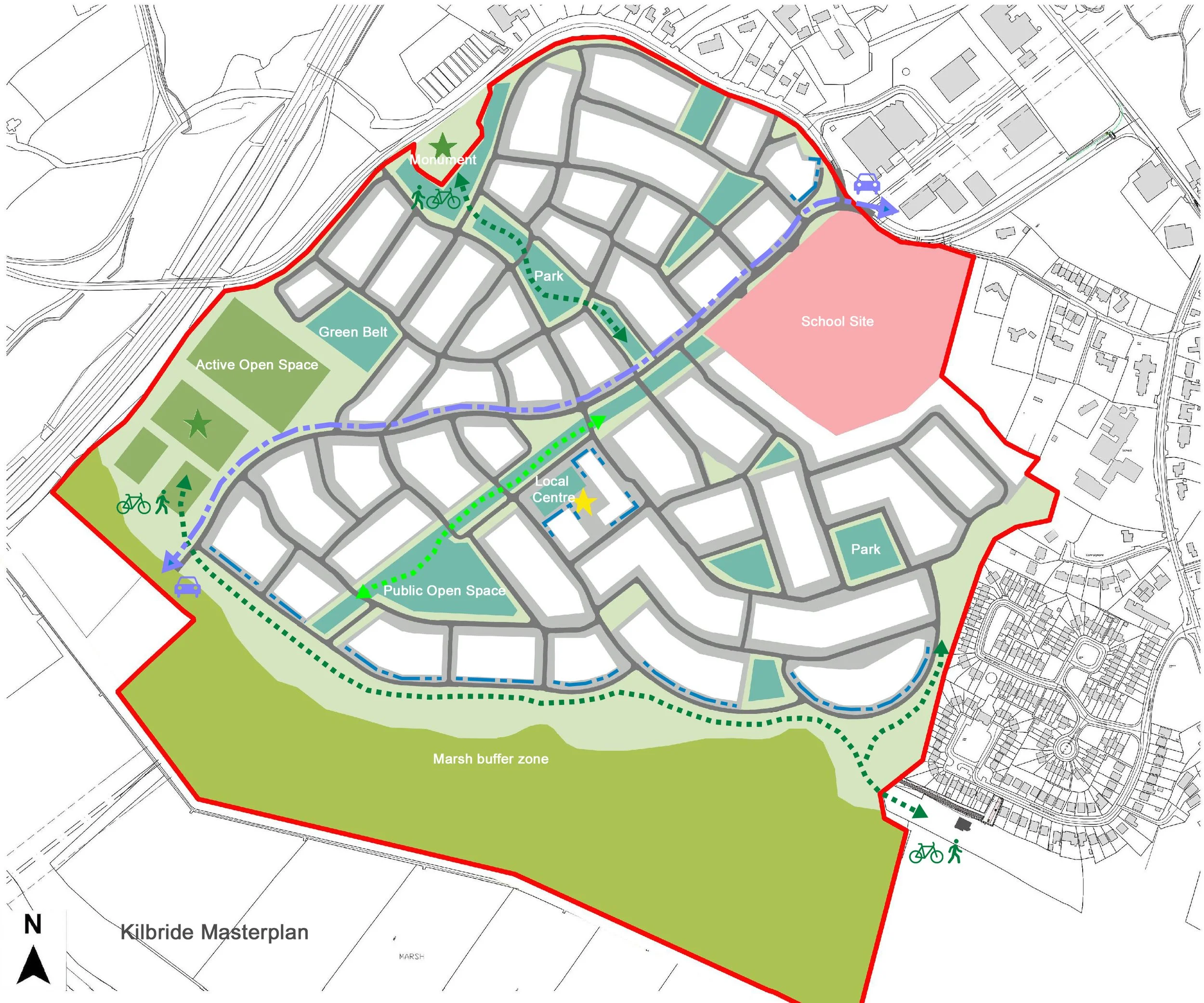
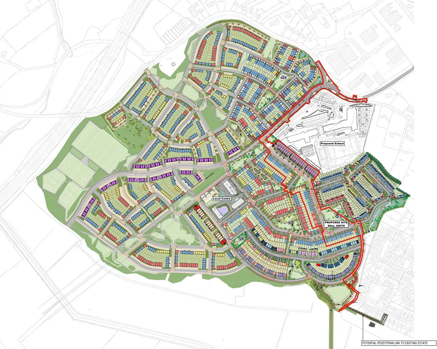
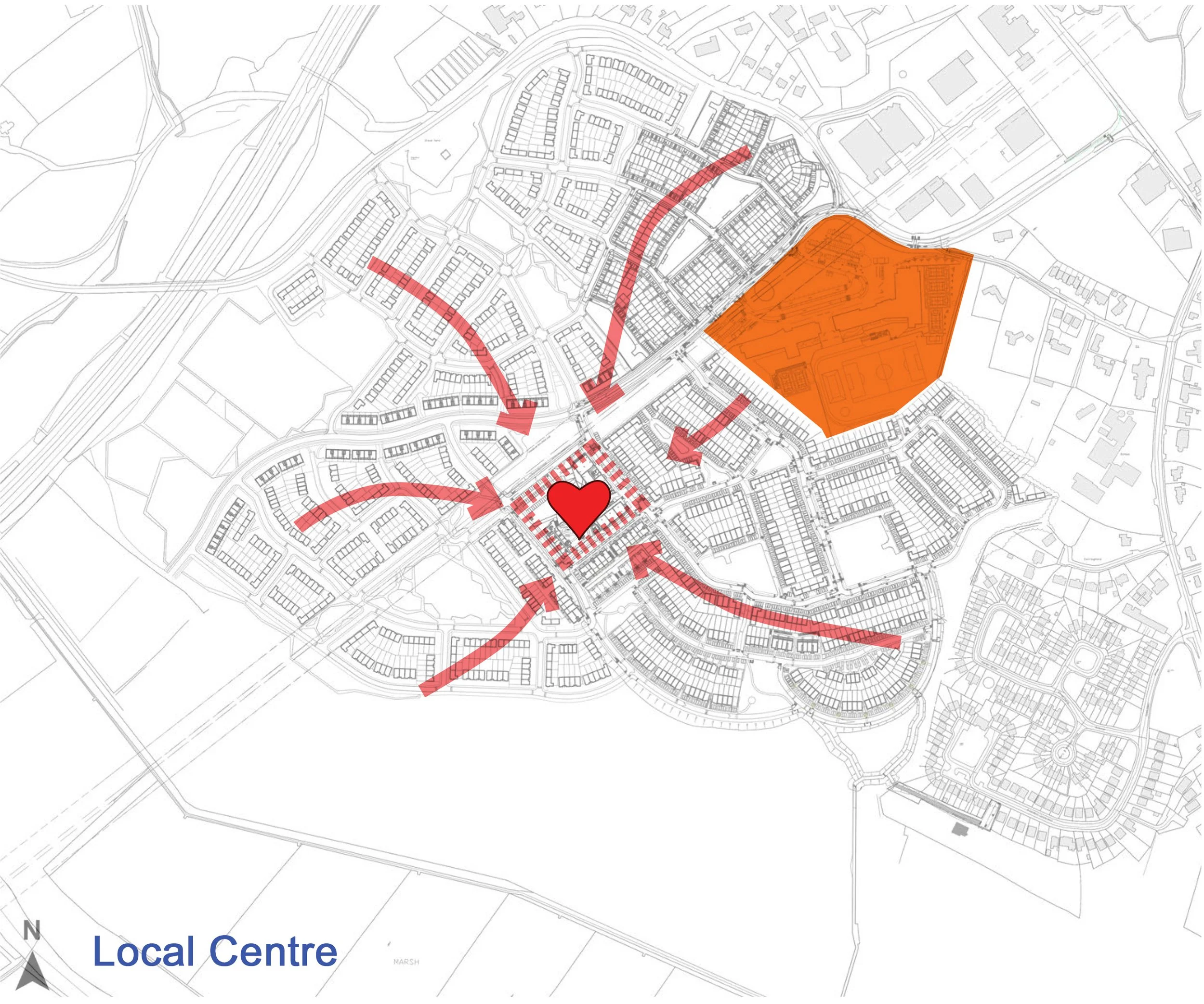
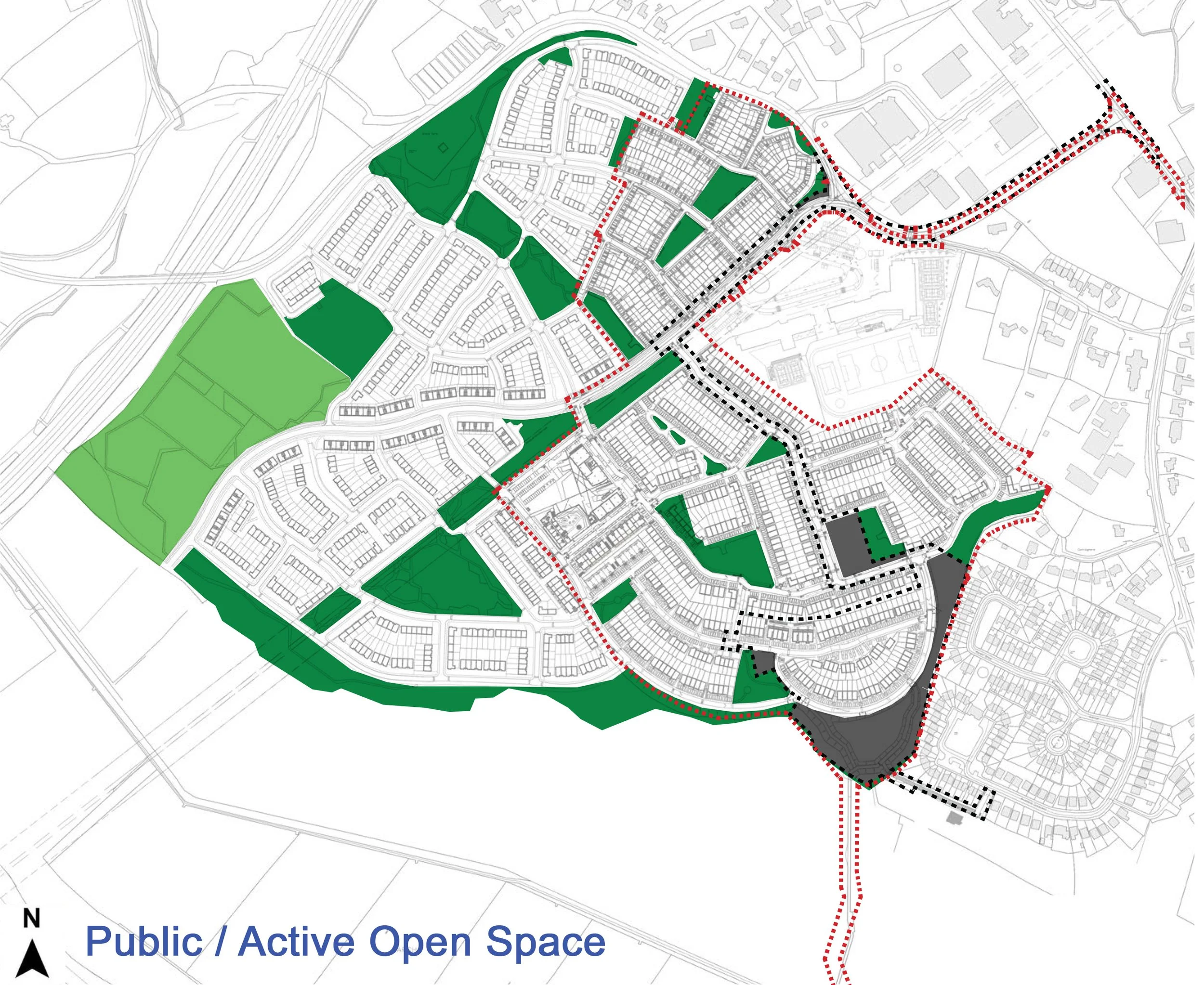
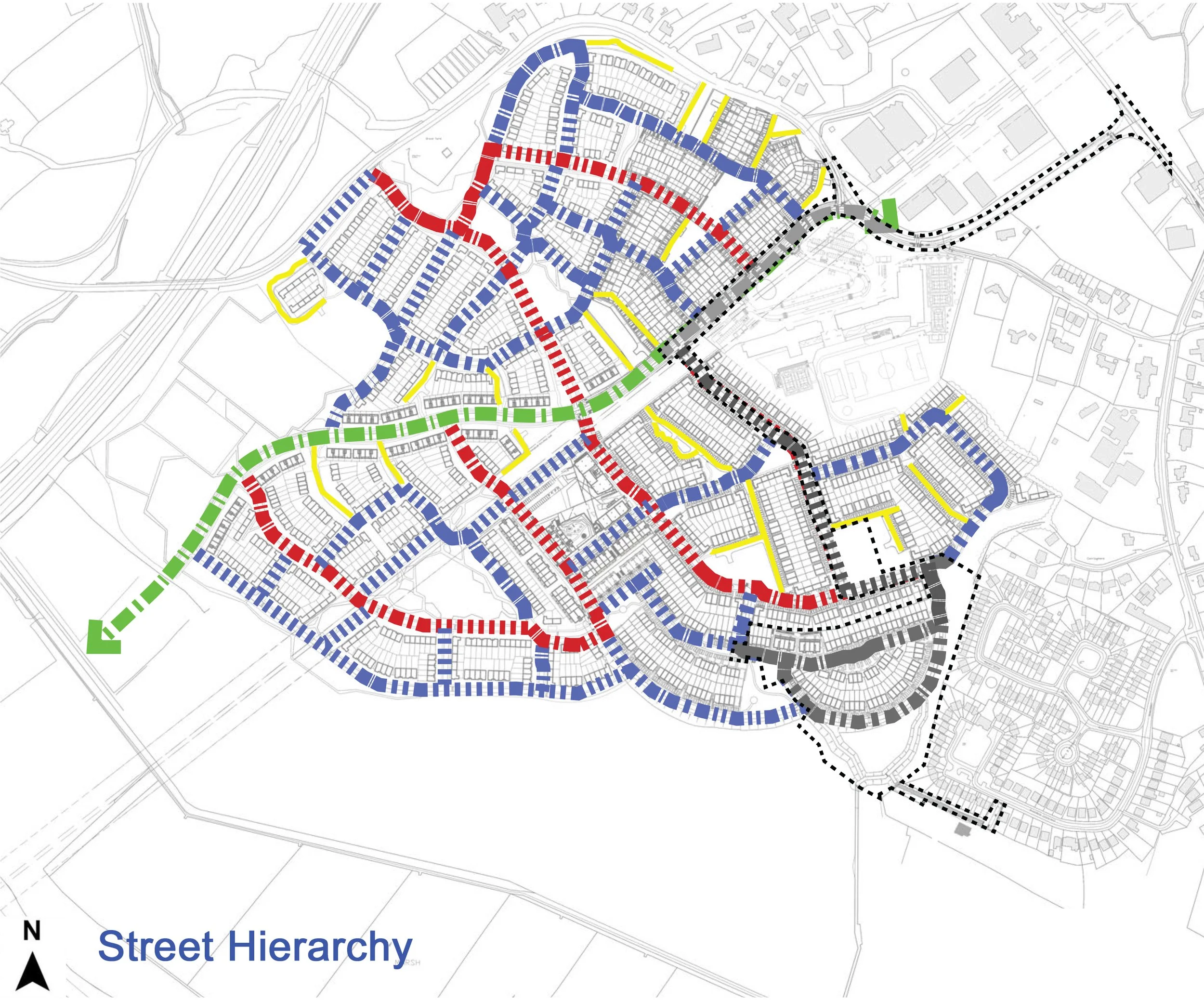
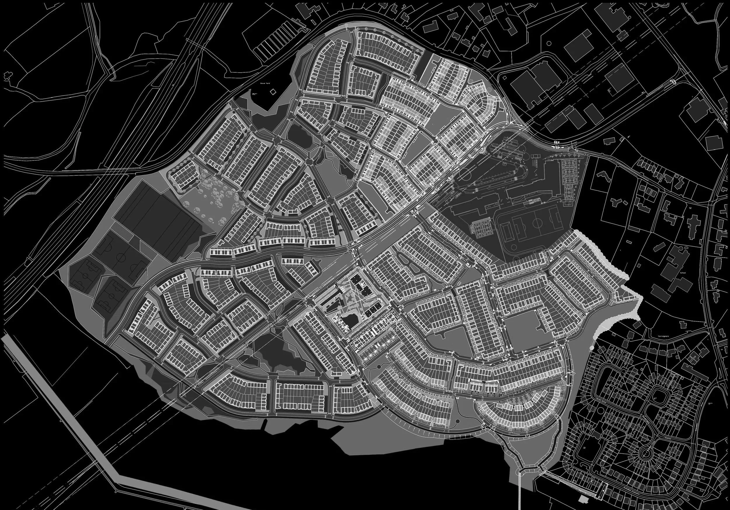
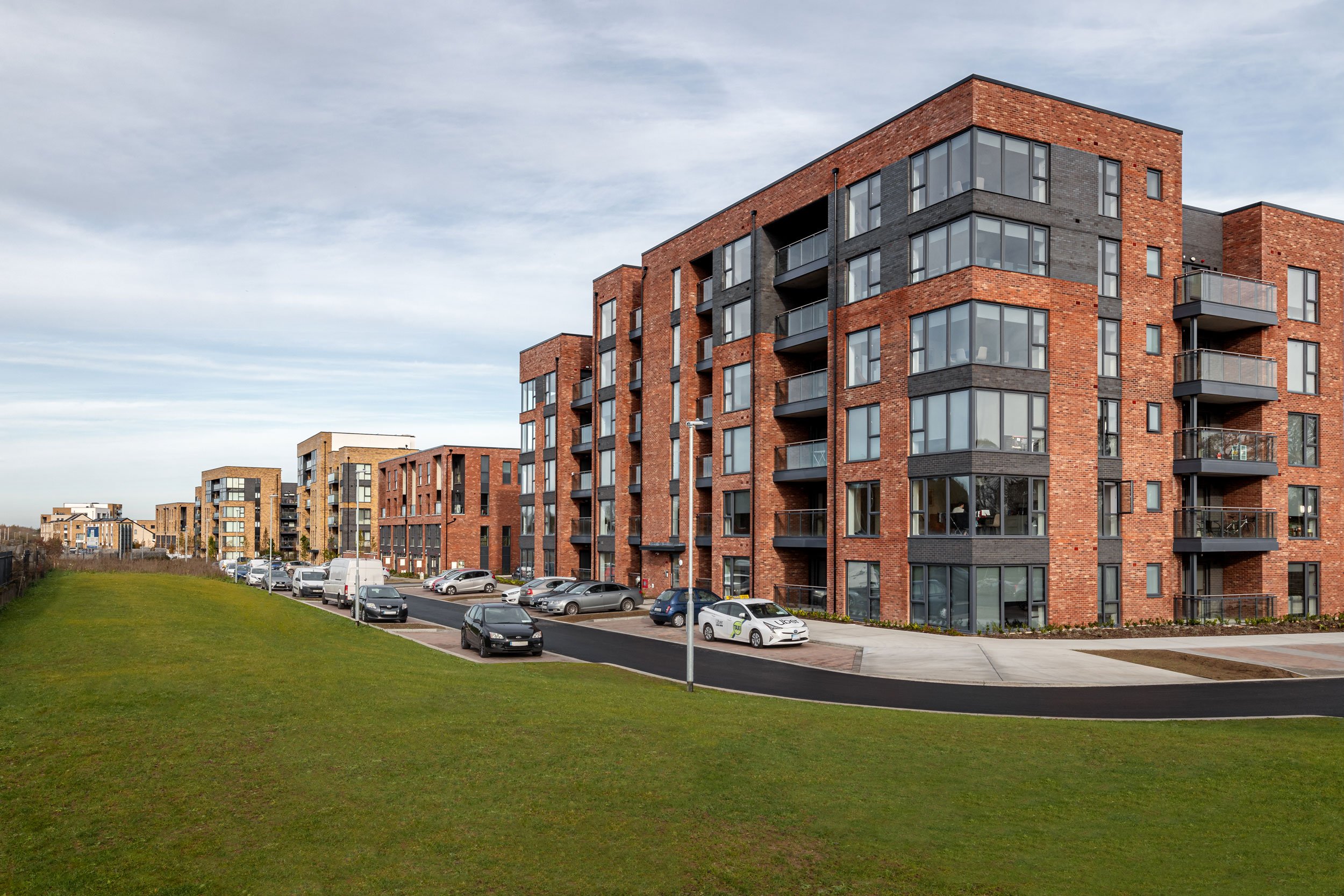
The Masterplan set out a framework for the delivery of 1500 new residential units and infrastructure at this 40 hectare site on the edge of Arklow County Wicklow.  The Masterplan was formulated on the basis of a strong hierarchy of streets and green spaces linked together by pedestrian and cycle routes. Proximity to open space and views in and out of the site were key drivers along with sensitivity to the marsh lands of the Avoca river to the south and the historic pyramid of Arklow in the graveyard to the north. The plan identified a location for a Local Centre at the heart of the development, along with creches, new schools and areas for Active and Public Open space.

Client: Certain Assets of Dawnhill and Windhill Limited

Site Area: 40ha

Unit No. 1500

Units per Ha: 37

Black and white city map showing streets, buildings, parks, and sports fields with detailed neighborhood layout.

More Like This