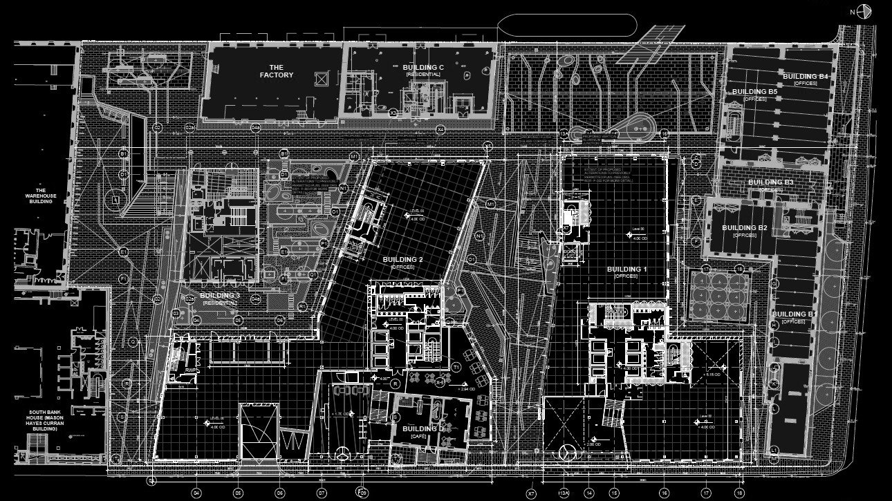
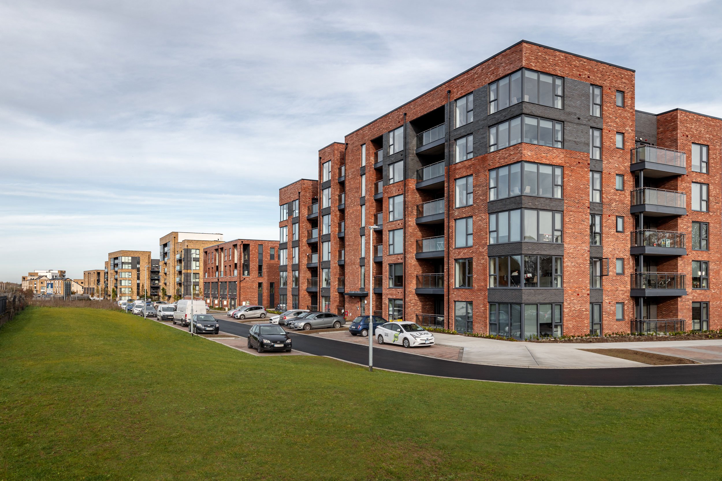
Bolands Mills

A line drawing of the city skyline with labeled features: rhythm of the city skyline and tapering forms on the water.
Site plan showing buildings, roads, and public spaces with color-coded zones for offices, residential areas, cafes, and green spaces, including labels and directional arrows.
A cityscape sketch featuring a large multi-story building with the words 'SOLANDS TOUR MITS' on its facade. People are walking on the street, some near trees and outdoor seating areas, with shaded awnings visible.
A 3D architectural model of a city block showing buildings, water, and parking areas, with a red boundary outline surrounding the site.
A 3D architectural diagram of a city block shows an outlined building surrounded by multiple colored lines and arrows indicating movement or directions, with a body of water nearby.
A map of an industrial area showing old corn store, grain silo, steam winter mill, spring mill, Bolands experimental bakery, Bolands offices, Perrin's houses, Perrin's yard, and surrounding buildings near a body of water.
A 3D map of a city block highlighting a specific building complex, with blue markers indicating points of interest near the entrance. The area includes water bodies and surrounding buildings.
Site plan of a historic stone mill complex near Water Grand Canal Dock, showing various buildings labeled A to G, with structures including stone factory, stone mill, warehouses, and silos, along with streets named Ringsend Road and Barrow Street.
Sketch of a city street scene with people walking, surrounding buildings, trees, and a large sign reading 'ISLAND' on one building.
Site plan for an urban development project showing a waterfront area with a dock, public square, green amenity space, streets, and pathways, with directional annotations for sunlight and connections to the theater quarter and city center.
A sketch of a city park with people walking and sitting on benches, surrounded by buildings and trees, with a blue sky overhead.
Map of a festival ground showing stages named Theatre, Altovetro, Montevetro, Landsdowne Road Stadium, and Gasworks, with pathways and a surrounding waterway, including Sadhorma Strand and a park with a mountain symbol.
A city map showing buildings, streets, and waterways with four orange-highlighted areas.
Map highlighting the Grand Canal Dock area, including Boland's Mill canal basin, Googletwo, and surrounding neighborhood.
A map showing a layout of buildings, roads, and waterways with a red-highlighted building.
Line drawing of an outdoor city scene with people sitting at tables, walking, and standing near a building with a sign that says 'museum'. Tall buildings and flags are visible in the background, with a clear sky.
Architectural blueprint of a building elevation showing multiple floors, entrances, and surrounding landscape features, with annotations for residential, café, and pedestrian areas.
People walking and socializing in an outdoor urban space with stairs, trees, and modern buildings, in a daytime setting.
Site plan of a mixed-use redevelopment project showing existing and new buildings, streets, public spaces, offices, cafes, and parking. Key annotations include levels, flood-resistant features, and access points.

Project Overview

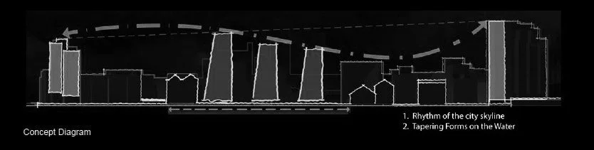
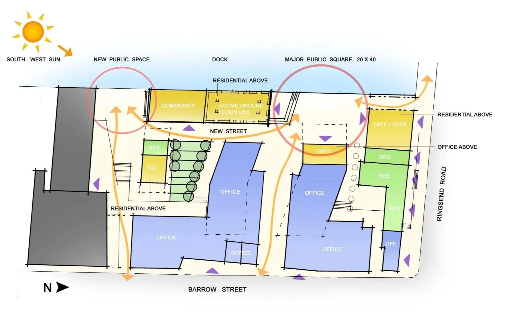
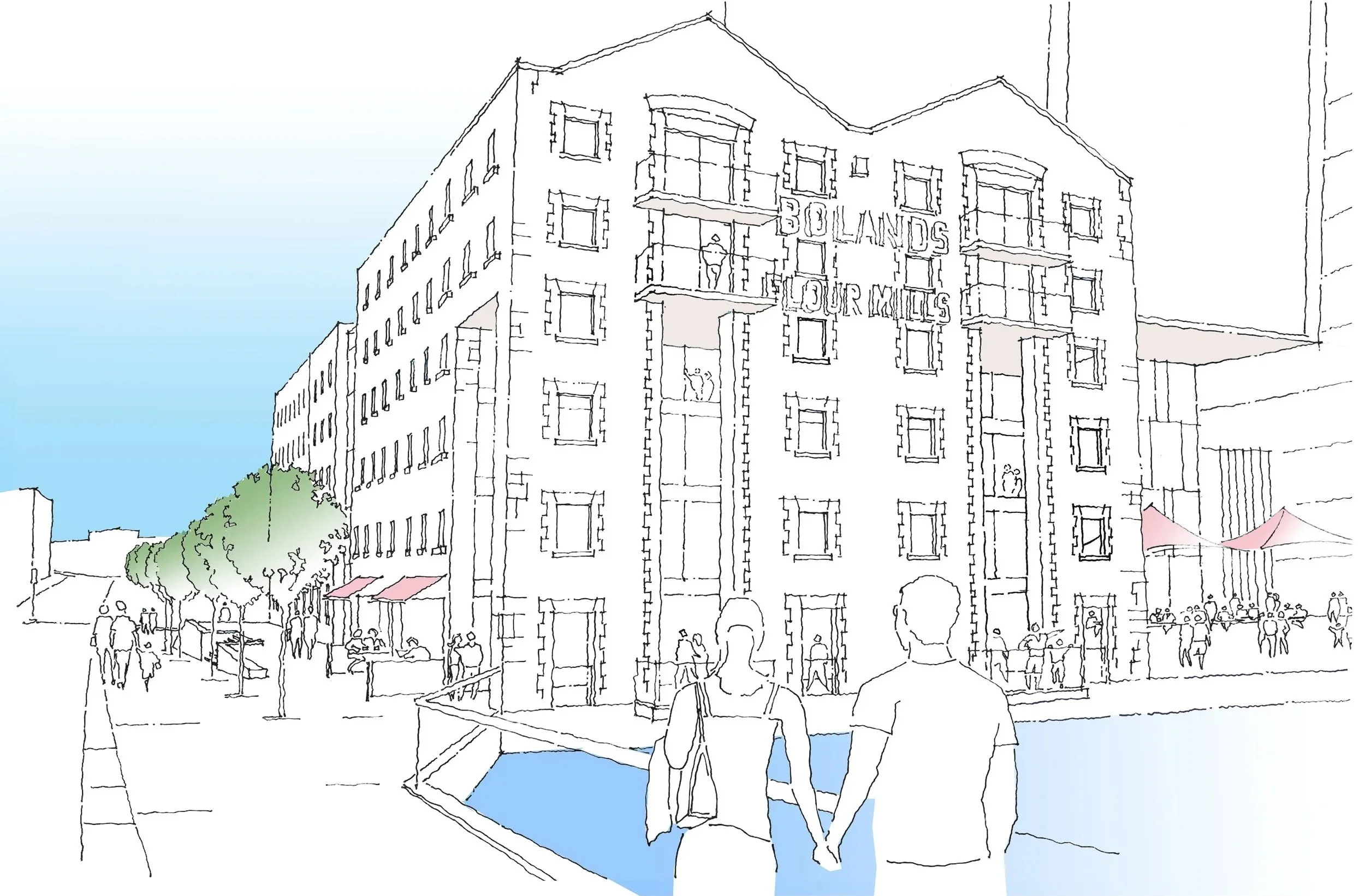
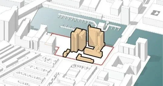
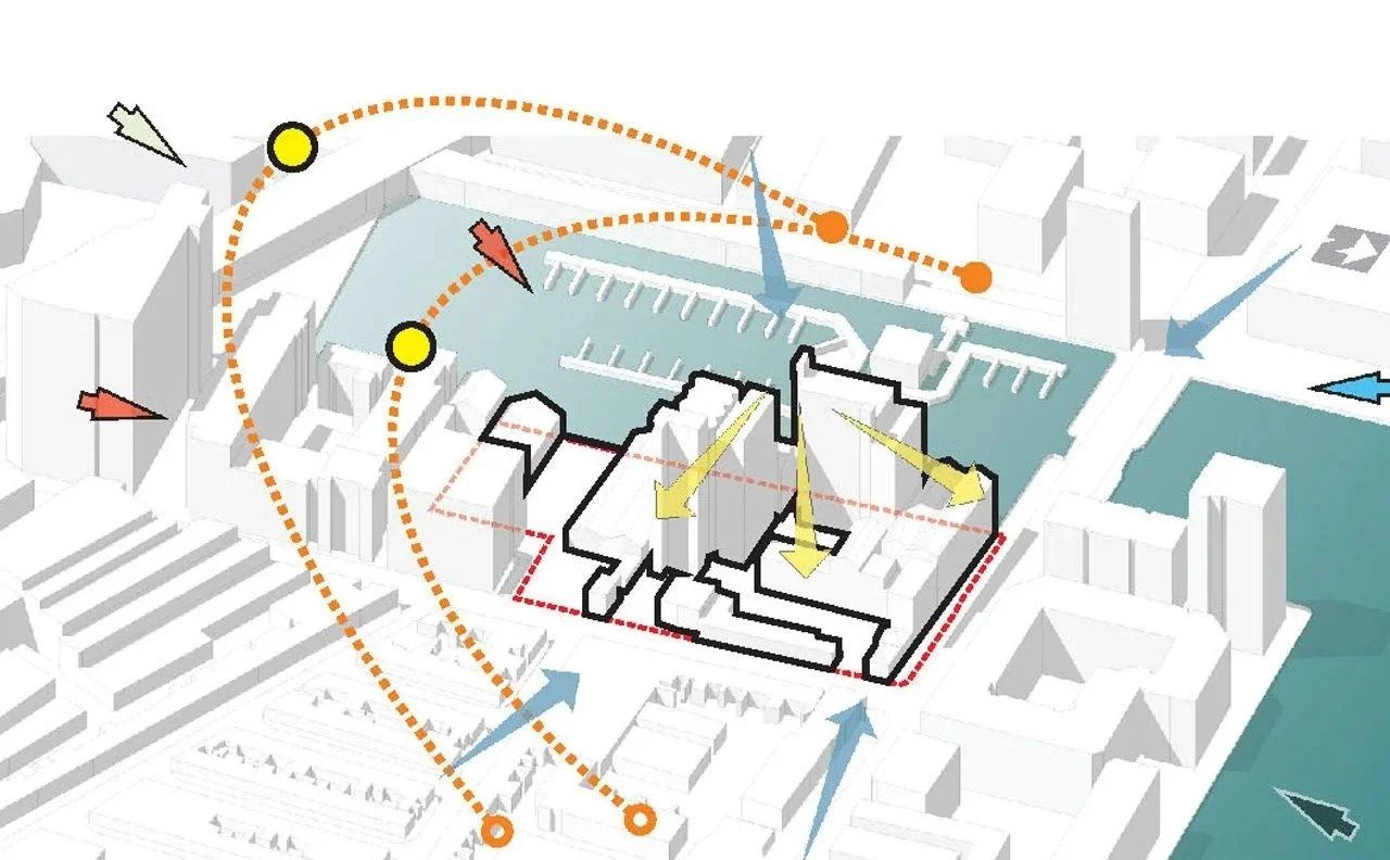
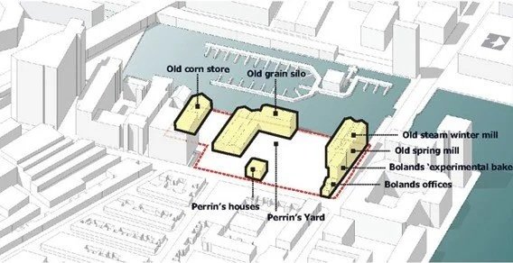
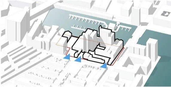
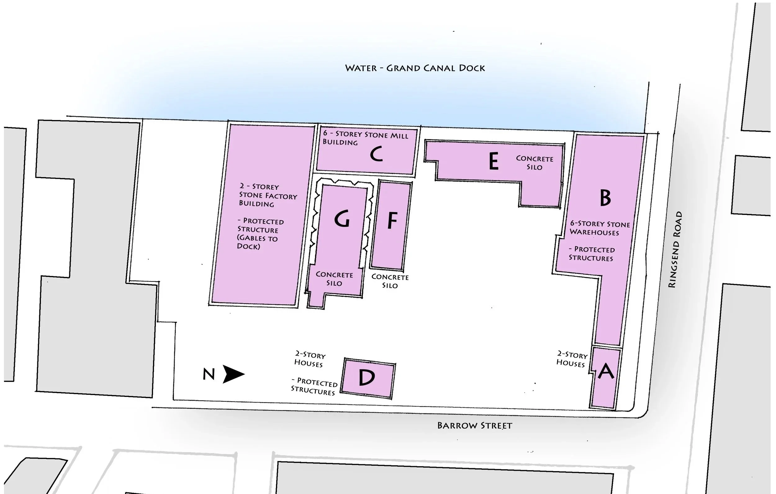
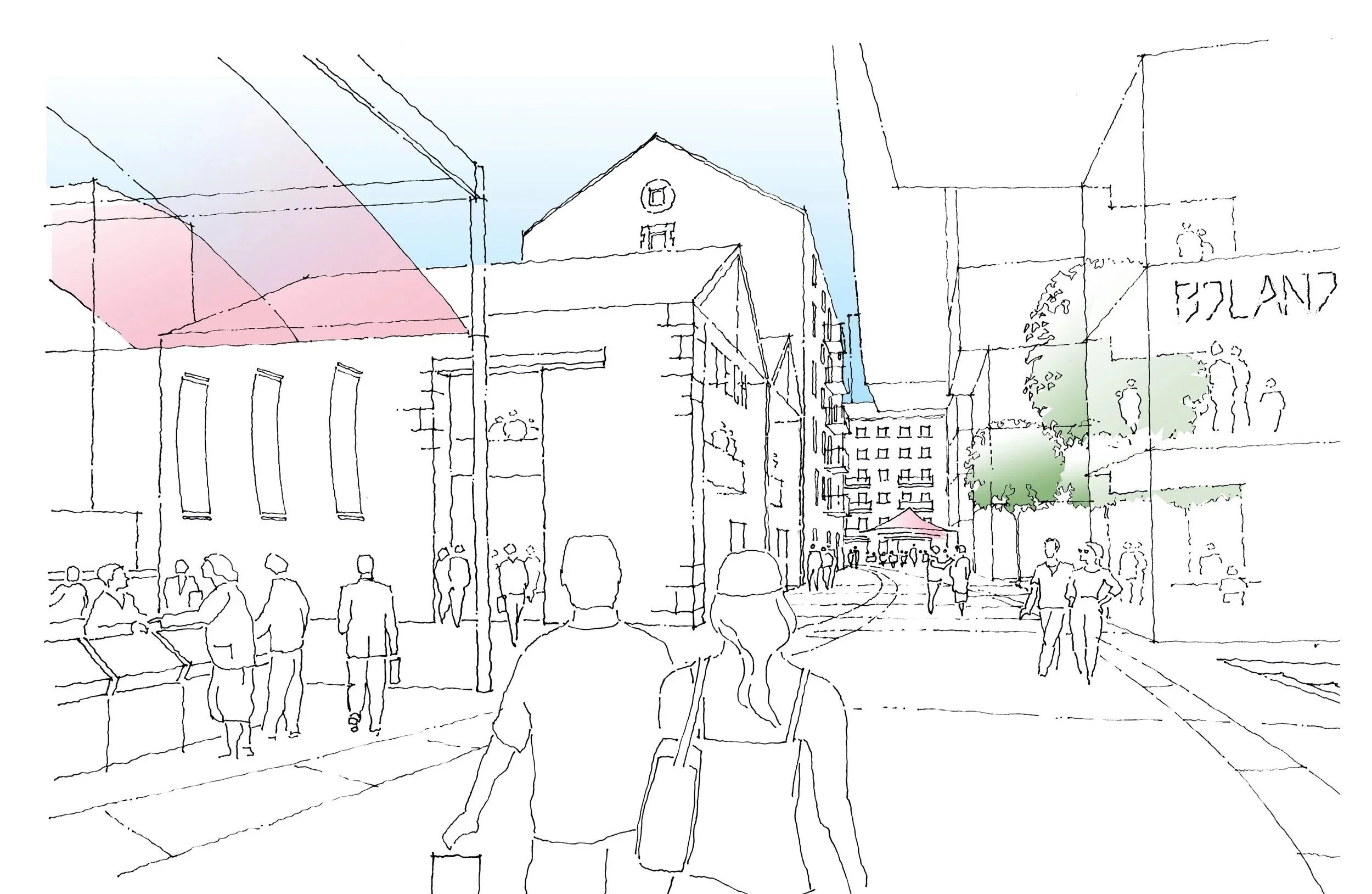
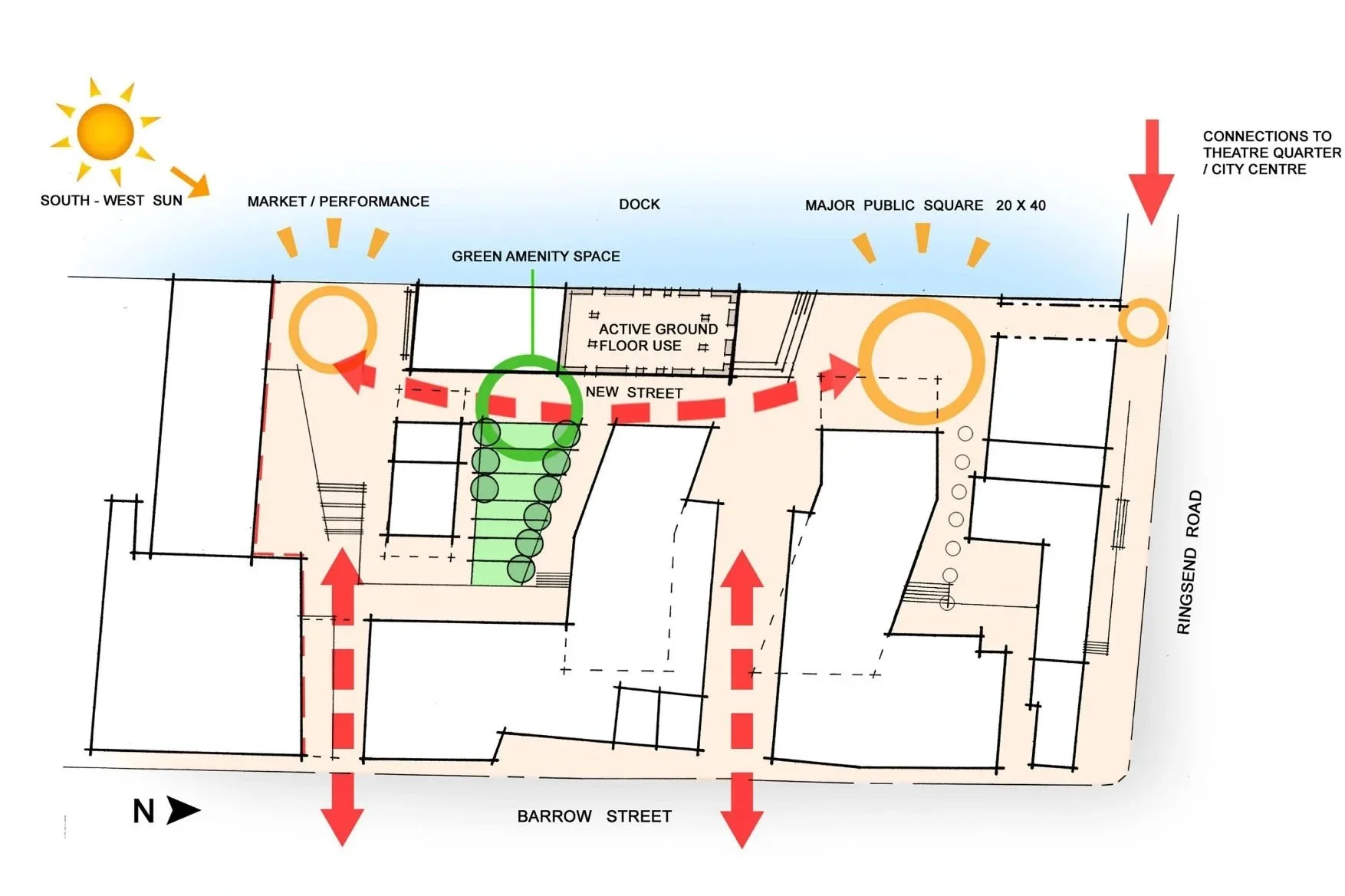
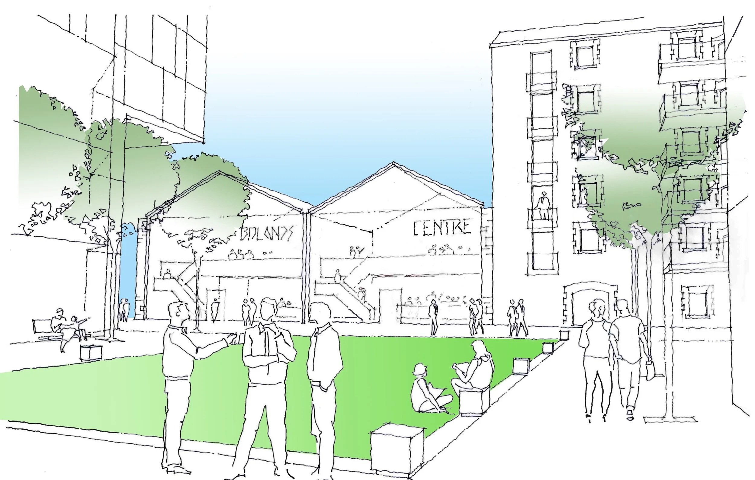
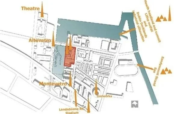
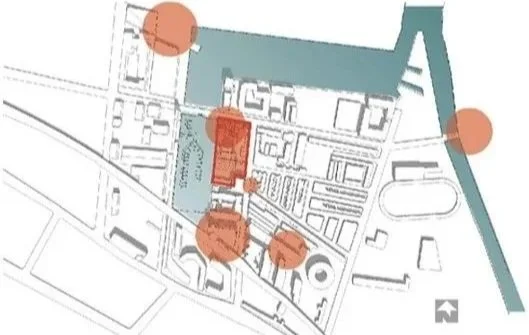
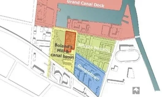
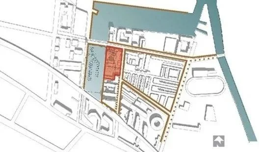
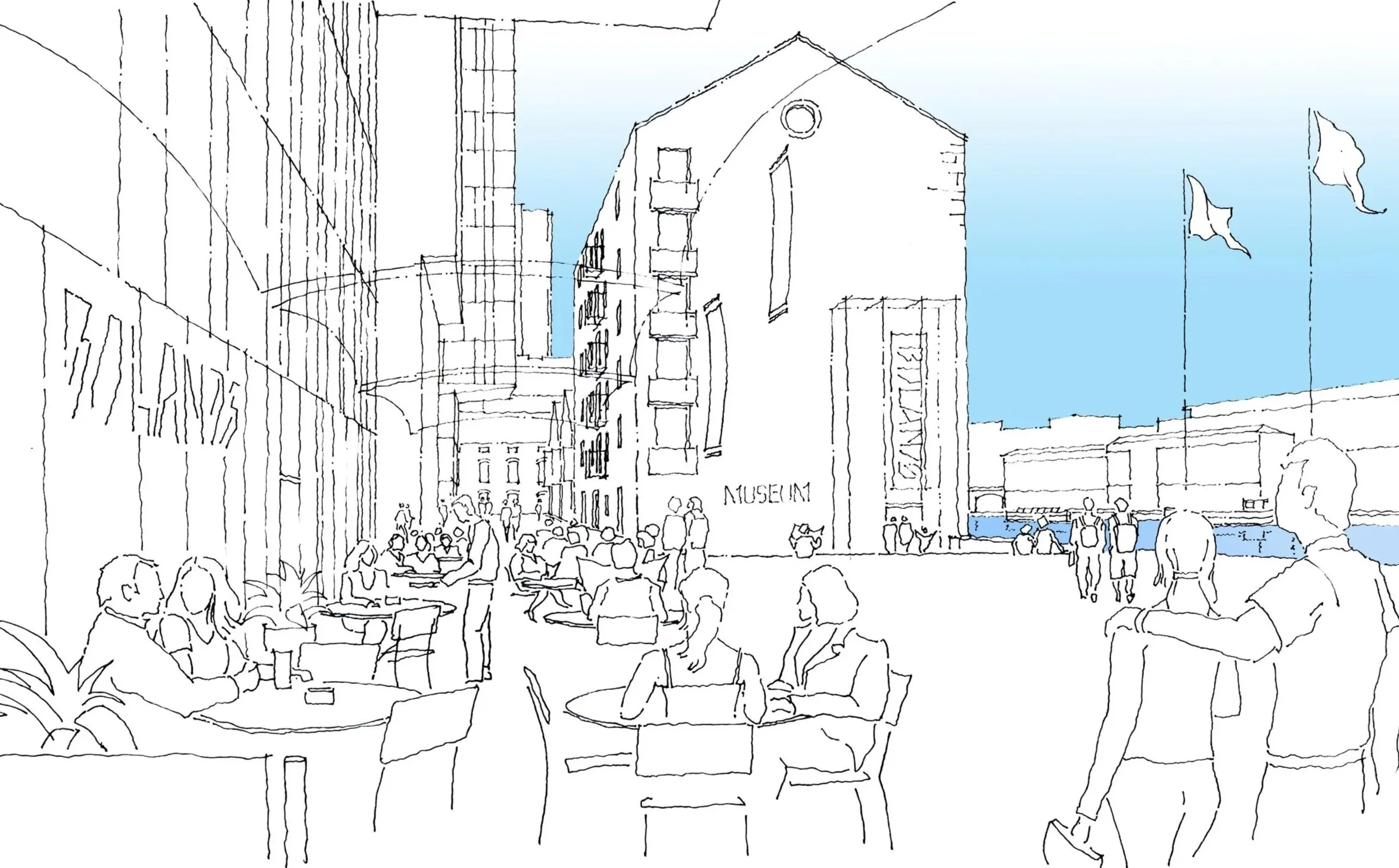
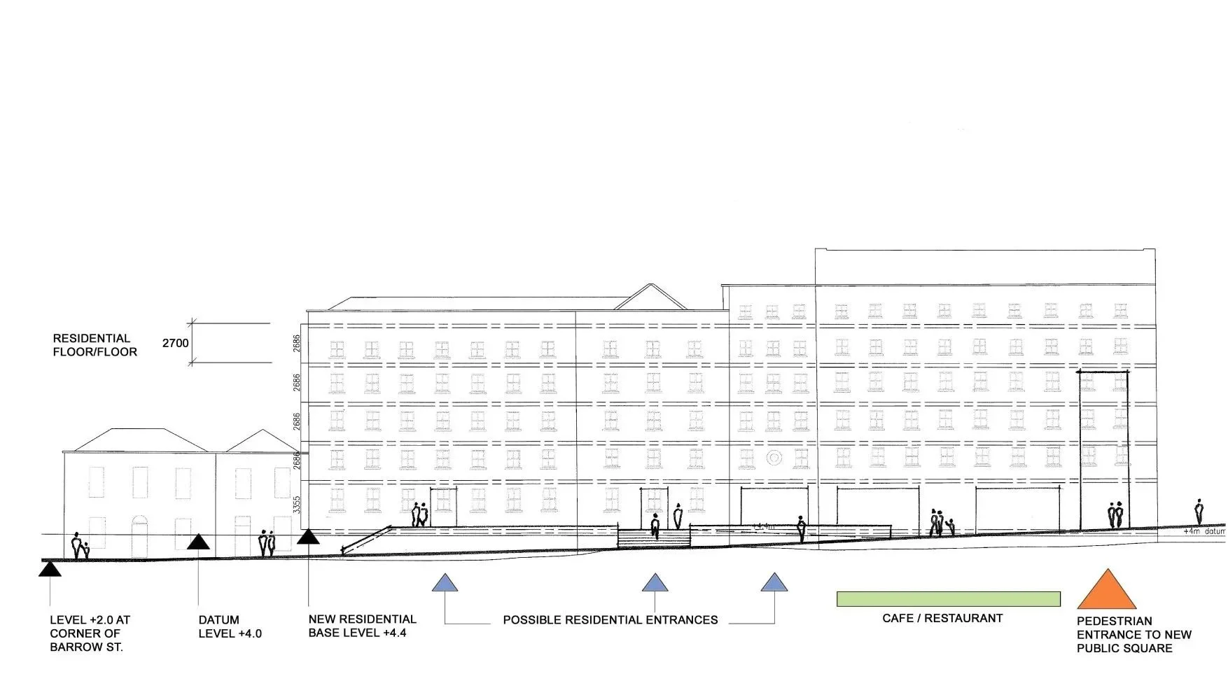
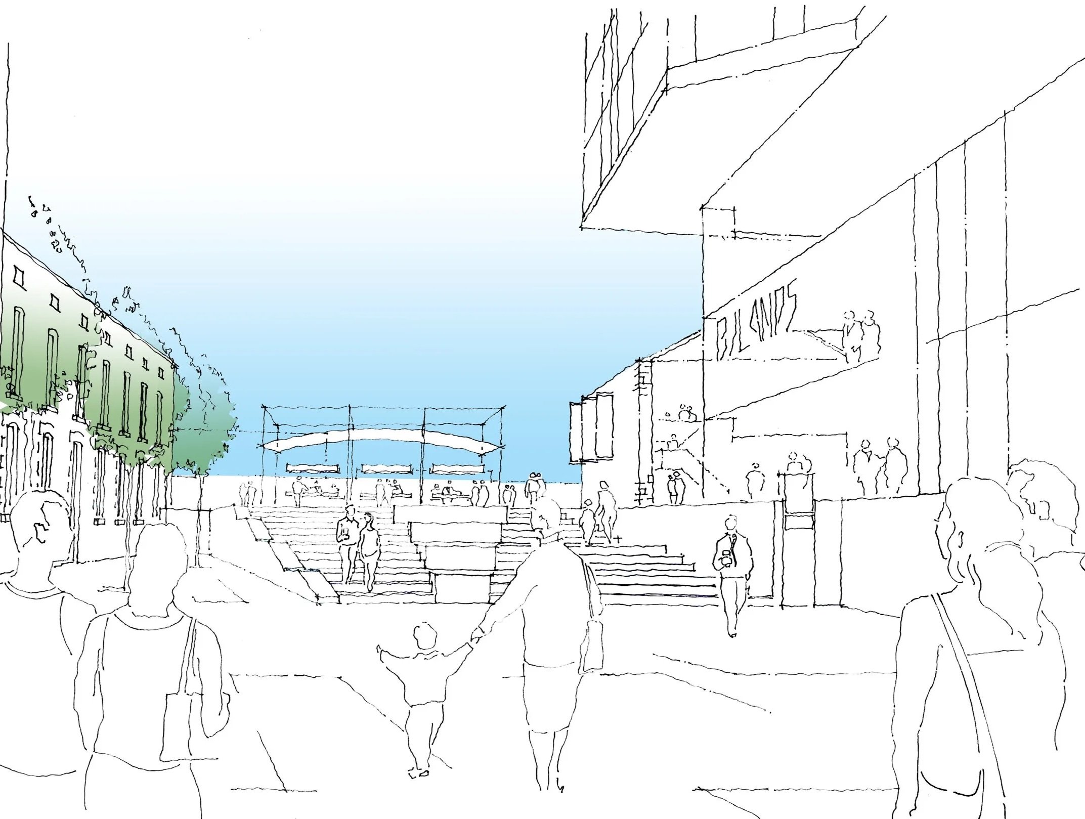
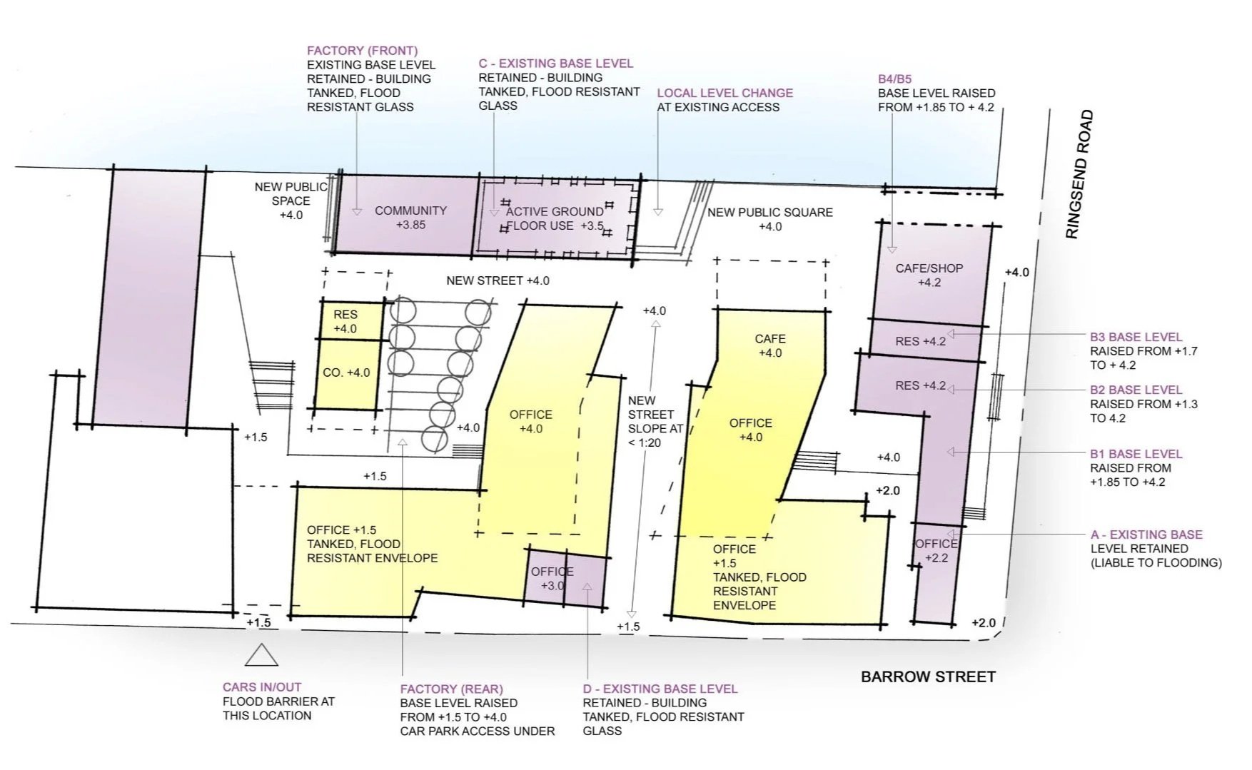
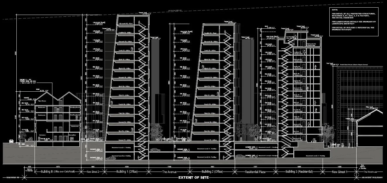
BKD Architects undertook an extensive consultation exercise with Dublin City Council to inform the formation of the North Lotts and Grand Canal SDZ Planning Scheme, and particularly the Masterplan diagram for this key site. The approach focused on the retention and reuse of the sites protected structures; whose industrial heritage gives the site such character, balanced against the desire for new pedestrian routes through the site to the Grand Canal Basin. A new bridge connection from the site to Ringsend Road was identified at the outset as a key driver of movement along with vibrant active ground floor uses to the streets and public spaces. General strategies for flood protection of both new and old buildings were also critical factors in establishing the principles for future development.

Completed: 2022

Client: NAMA

RIAI Stages: 1 to 7

Site Area: 1.32ha

Unit No. 36

Units per Ha: .029

Architectural blueprint of a multi-building urban development, including office, residential, and retail structures, with labeled sections and measurements.
A detailed black and white architectural site plan showing multiple buildings, parking lots, roadways, and landscaping features labeled with names and functions.

More Like This